Contributing to OpenStreetMap is diversely rewarding: you help other people, you make open data as a whole more viable, you learn a lot about the area you’re mapping, and it’s fun. But sometimes it’s just plain pragmatic. Last weekend, I organised a cycle tour from Bendigo to Avenel, via the O’Keefe Rail Trail, Lake Eppalock, Colbinabbin, Rushworth, Murchison and Nagambie. When I started planning the route, OpenStreetMap looked like this:
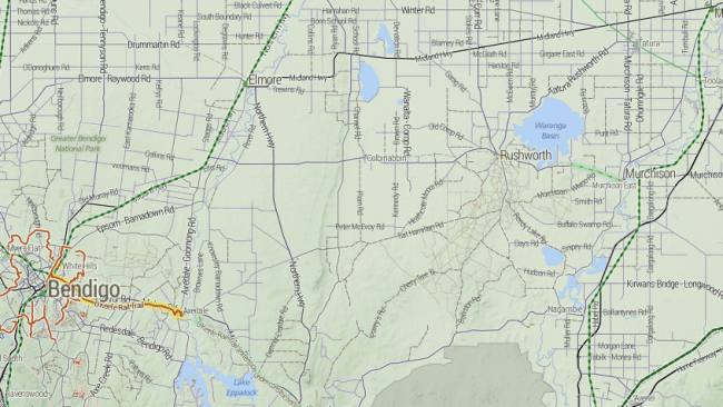
The major features are all there, but what’s missing is what matters most to cycle tourists: quiet country roads, and road surfaces. Is there a way to get from Eppalock to Colbinabbin on only sealed roads? Is Buffalo Swamp Rd (near Murchison) really sealed? A great way for me to research is to add to OpenStreetMap: use aerial imagery to add new roads, paying attention to whether they look sealed or not from the air.

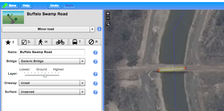
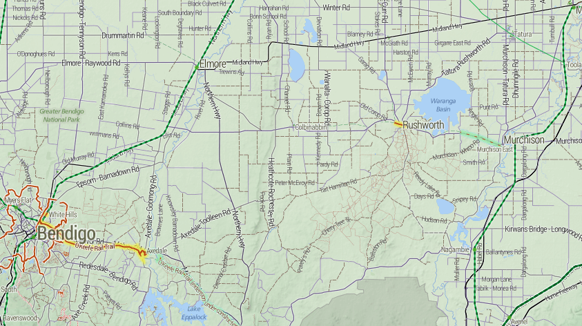
So Buffalo Swamp Road is obviously not sealed after all. By the time I was done, the map of the area looked like this:

Notice how many “sealed” roads have turned out to be dirt, but also how many other unmapped little roads have been added to the map.
Once this is done, the steps are:
- Finalise the route, using OSRM.
- Send GPX files to everyone on the trip
- Load the GPX files onto both my GPS and Maverick Pro, an Android App
- Also load the cycletour.org tiles into Maverick
- Ride
- Update OpenStreetMap afterwards with any fresh information – obstacles, unexpected connections, local businesses, and so on.
There’s still lots more to add, but it’s nice that just planning this one trip has significantly improved coverage in a whole region like this.


Recent Comments