Steve Bennett blogs

…about maps, open data, Git, and other tech.

Category Archives: Cycling

Cycletour.org: a better map for Australian cycle tours

Cycletour.org is a tool for planning cycle tours in Australia, and particularly Victoria. I made it because Google Maps is virtually useless for this: poor coverage in the bush and inappropriate map styling make cycle tour planning a very frustrating experience.

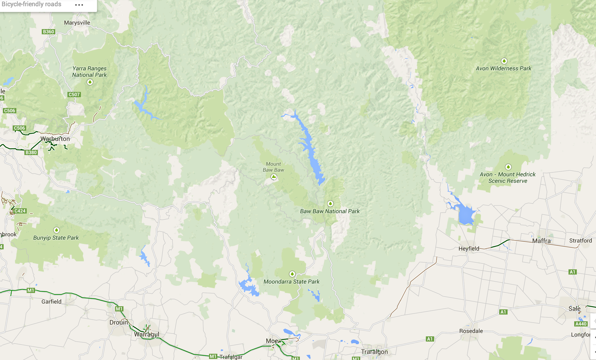
Let’s say we want to plan a trip from Warburton to Stratford, through the hills. This is what Google Maps with “bicycling directions” offers:

Google Maps - useless for planning cycle tours.

Google Maps – useless for planning cycle tours.

Very few roads are shown at this scale. Unlike motorists, we cyclists want to travel long distances on small roads. A 500 kilometre journey on narrow backstreets would be heaven on a bike, and a nightmare in a car. So you need to see all those roads when zoomed out.

Worse, small towns such as Noojee, Walhalla and Woods point are completely missing!

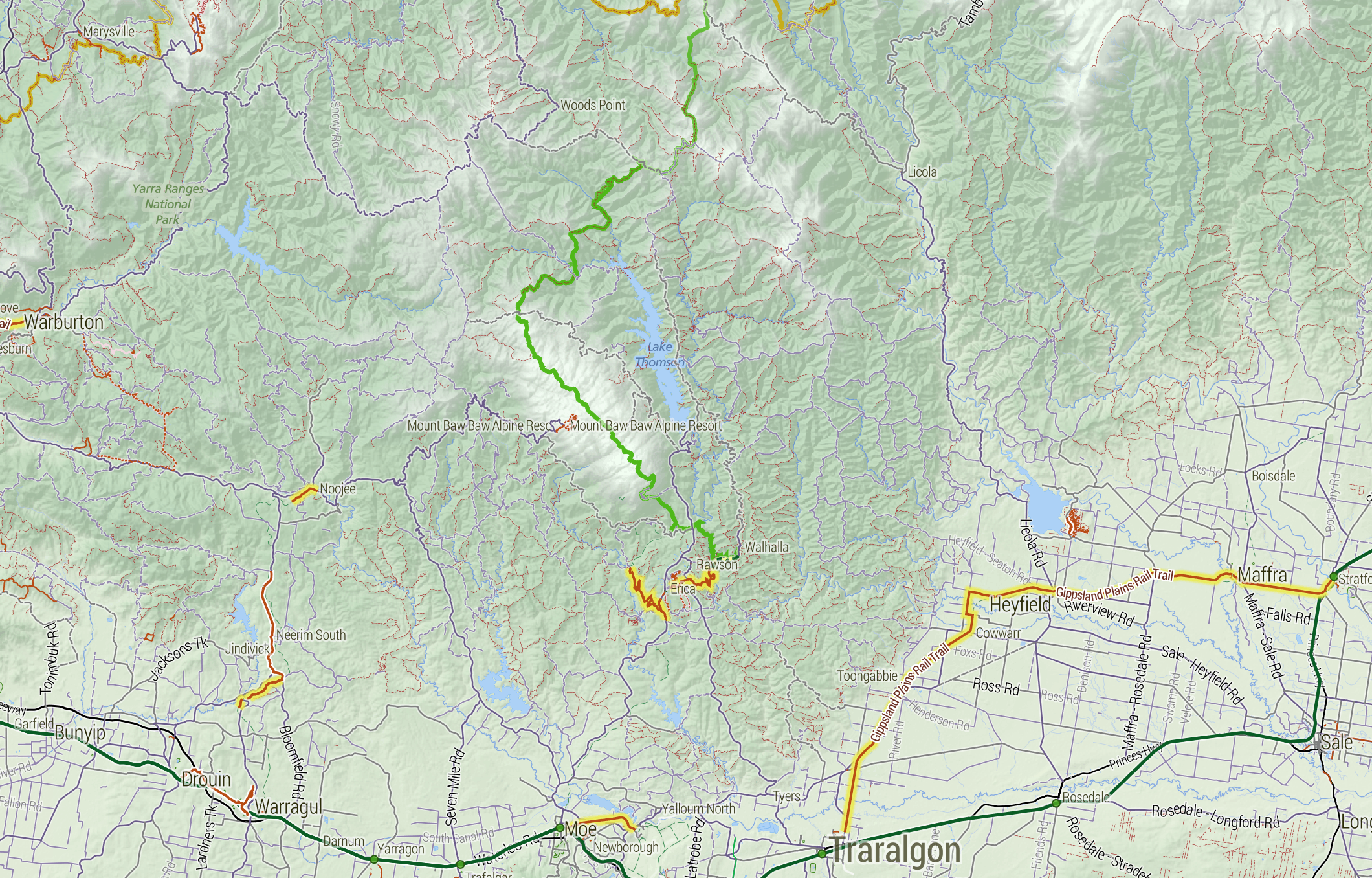
Enter Cycletour.org:

Screenshot 2015-01-09 18.03.59

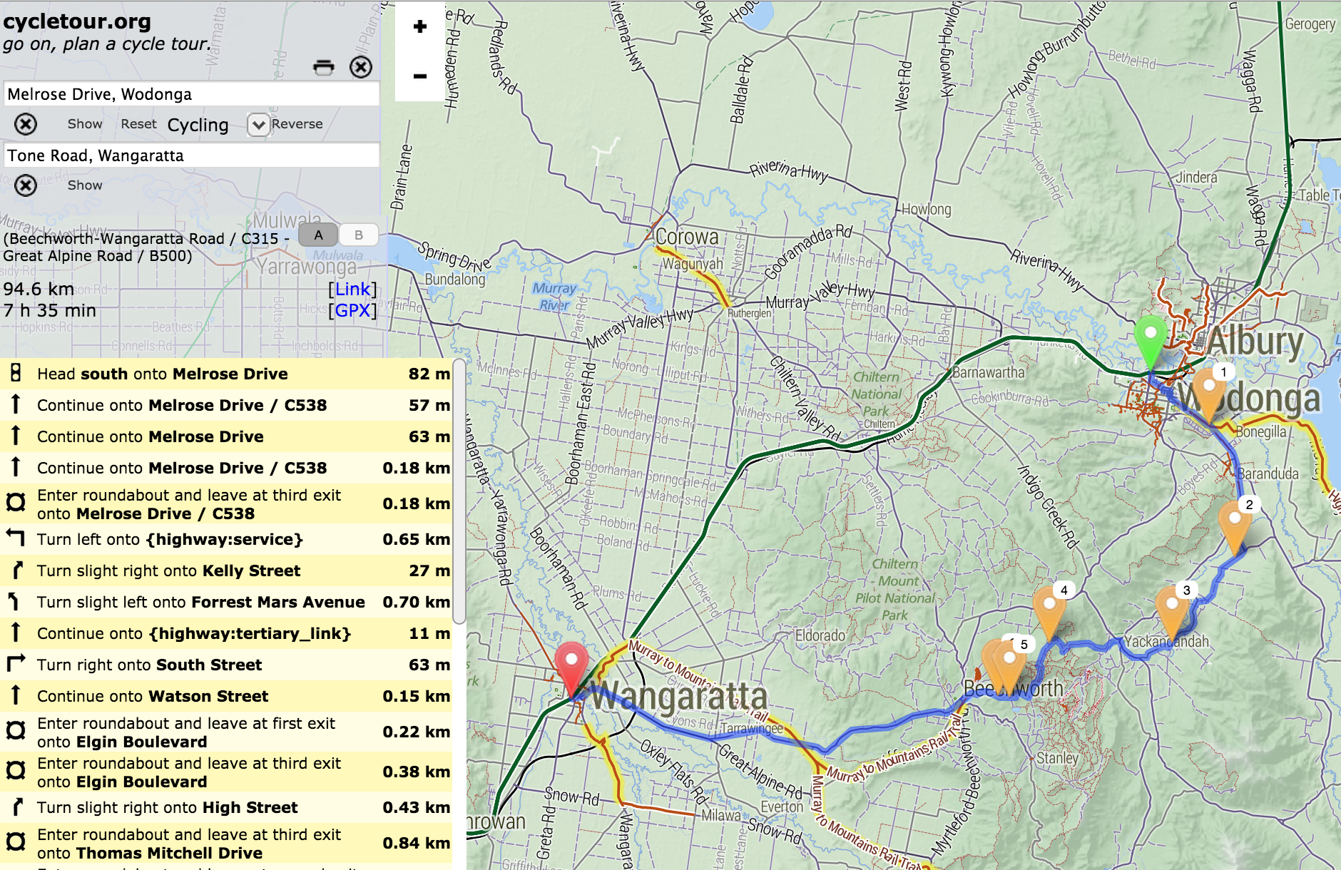
You can plan a route by clicking a start and end, then dragging the route around:

Screenshot 2015-01-13 23.43.12

It doesn’t offer safe or scenic route selection. The routing engine (OSRM) just picks the fastest route, and doesn’t take hills into account. You can download your route as a GPX file, or copy a link to a permanent URL.

Cartography

The other major features of cycletour.org’s map style are:

Screenshot 2015-01-09 18.12.04
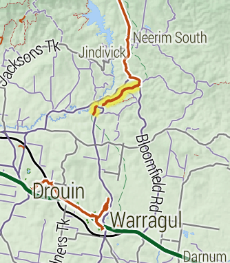
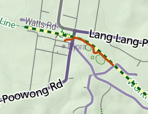
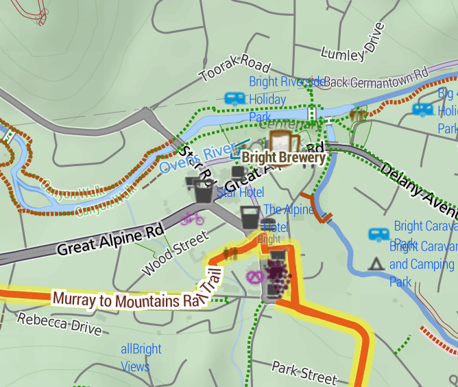
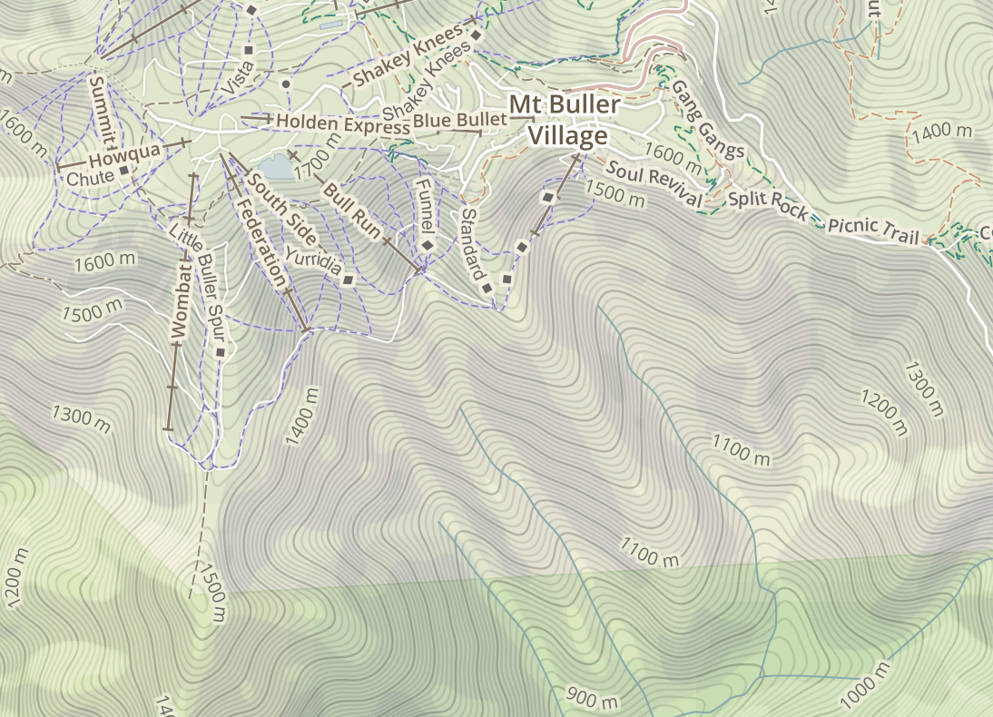
Bike paths are shown prominently. Rail trails (old train lines converted into bike paths) are given a special yellow highlighting as they tend to be tourist attractions in their own right.

Train lines (in green) are given prominence, as they provide transport to and from trips.


Screenshot 2015-01-09 18.20.23Towns are only shown if there is at least one food-related amenity within a certain distance. This is by far the most important information about a town. Places that are simply “localities” with no amenities are relegated to a microscopic label.


Screenshot 2015-01-09 18.27.40
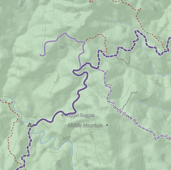
Major roads are dark gray, progressing to lighter colours for minor roads. Unsealed roads are dashed. Off-road tracks are dashed red lines. Tracks that are tagged “four-wheel drive only” have a subtle cross-hashing.

And of course amenities Screenshot 2015-01-09 18.57.40useful to cyclists are shown: supermarkets, campgrounds, mountain huts, bike shops, breweries, wineries, bakeries, pubs etc etc. Yes, well-supplied towns look messy, but as a user, I still prefer having more information in front of me.
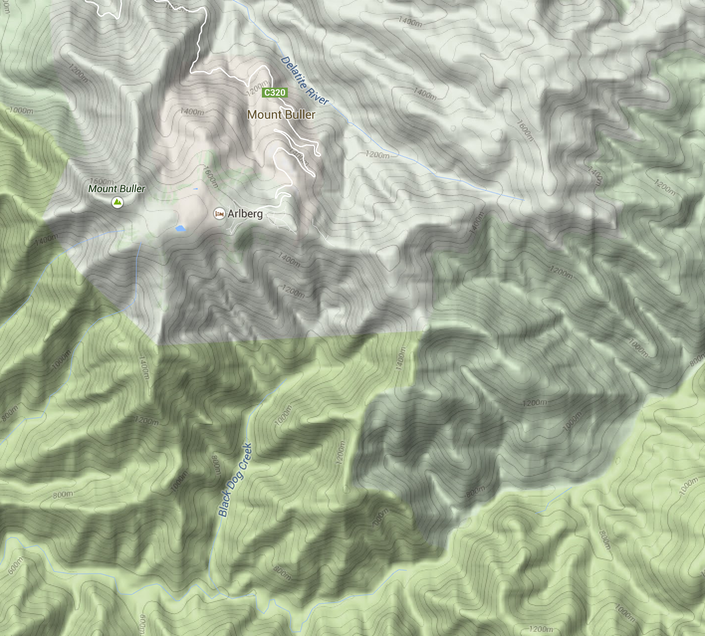
Terrain

Screenshot 2015-01-09 19.11.23The terrain data is a 20 metre-resolution digital elevation model from DEPI, within Victoria, trickily combined with a 90m DEM elsewhere, sourced from SRTM (NASA). I use TileMill‘s elevation shading feature, scaled so that sea level is a browny-green, and the highest Australian mountains (around 2200m) are white, with green between. 20-metre contours are shown, labelled at 100m intervals.

I’m really happy with how it looks. Many other comparable maps have either excessively dark hill shading, or heavy contours – or both.
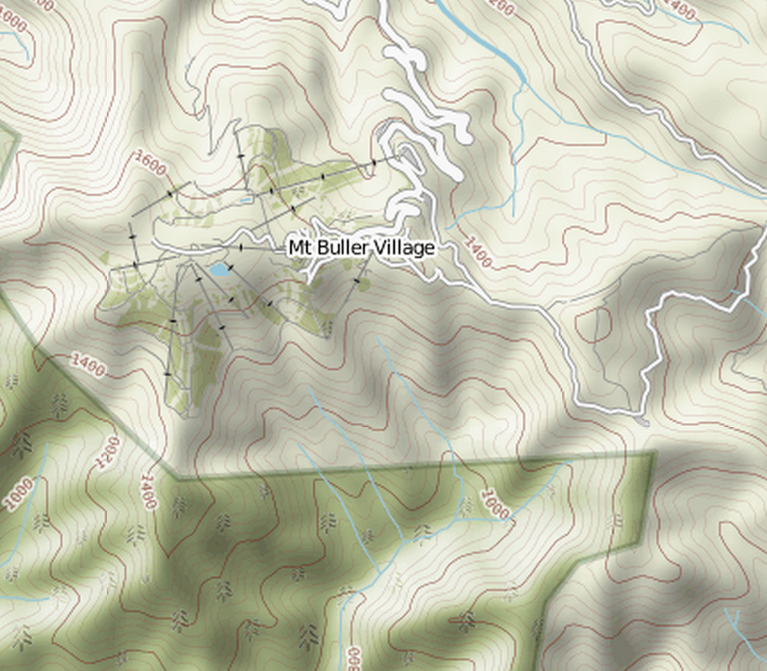
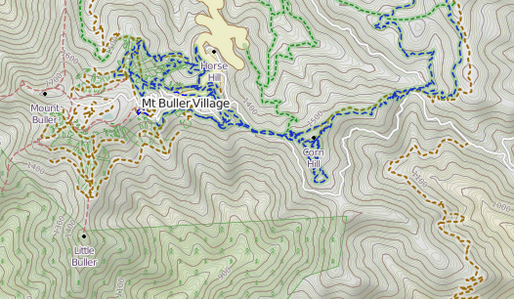
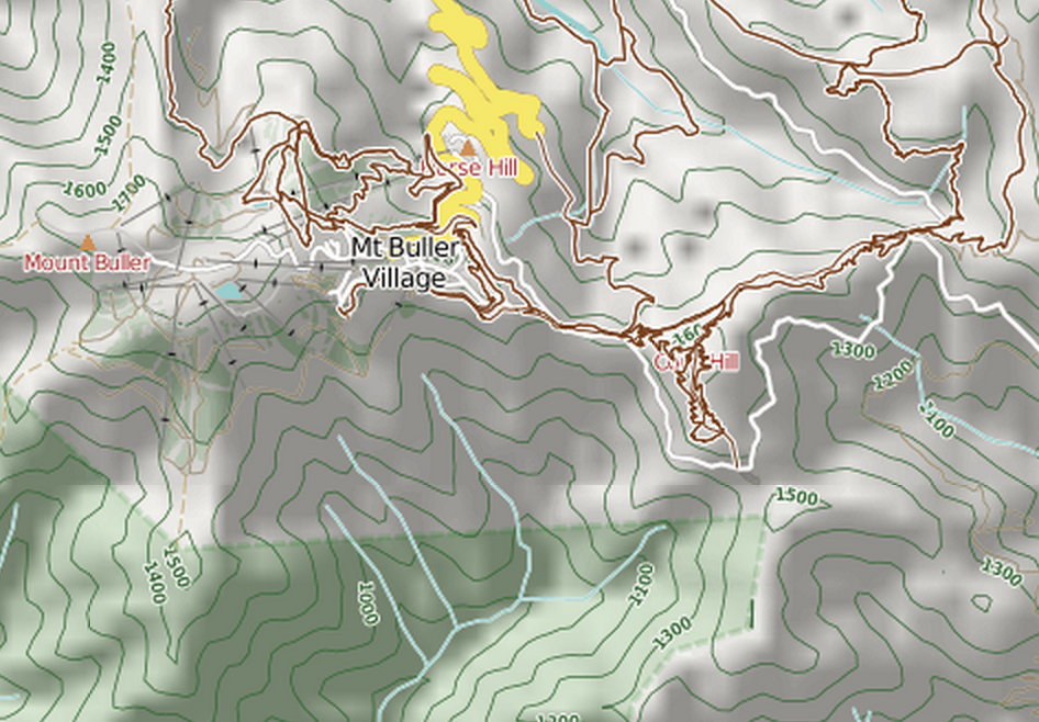
Screenshot 2015-01-09 19.21.02

4UMaps

Screenshot 2015-01-09 19.20.35

Komoot

Screenshot 2015-01-09 19.20.24

OpenCycleMap

Screenshot 2015-01-09 19.20.15

Sigma

Mapbox Outdoors

Google Maps (terrain mode)

Screenshot 2015-01-09 19.35.37

MapBox Outdoors


Other basemaps

Screenshot 2015-01-09 19.39.25

VicMap

I’ve included an assortment of common basemaps, including most of the above. But the most useful is perhaps VicMap, because it represents a completely different data source: the government’s official maps.

Layers

Vegetation

Vegetation

There are also optional overlays. Find a good spot to stealth camp with the vegetation layer.

Or avoid busy roads with the truck volume layer. This data comes from VicRoads.Screenshot 2015-01-09 19.47.43

The bike shops layer makes contingency planning a bit easier, by making bike shops visible even when zoomed way out. The data is OpenStreetMap, so if you know of a bike shop that’s missing (or one that has since closed down), please update it so everyone can benefit.

Screenshot 2015-01-14 00.06.20

Mobile

Unfortunately, the site is pretty broken on mobile. But you can download the tiles for offline use on your Android phone using the freemium app Maverick. It works really well.

Other countries

Screenshot 2015-01-14 00.46.05

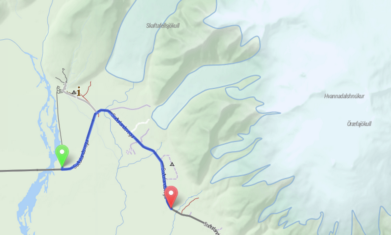
is.cycletour.org for Iceland. Yes, it’s real – but I don’t know how long I will maintain it.

It’s a pretty major technical undertaking to run a map for the whole world. I’ve automated the process for setting up cycletour.org as much as possible, and created my own version for Iceland and England when I travelled there in mid 2014. If you’re interested in running your own, get in touch and I’ll try to help out.


Feedback?

I’d love to hear from anyone that uses cycletour.org to plan a trip. Ideas? Thoughts? Bugs? Suggestions? Send ’em to stevage@gmail.com, or on Twitter at @Stevage1.

The Australian’s menacing editorial

An editorial published in The Australian on the 21st of March set a new low standard in writing about conflicts between cyclists and cars. Prompted by video of a cyclist colliding with a taxi door, the editorial combined a strong anti-cyclist viewpoint (as it’s entitled to do in the opinion section) with some astonishing ignorance and lousy argumentation.

It’s so terrible, I’ve commented on each sentence. (Even the grammar is bad: “The problem of city cyclists reached their apogee…”, “clogging-up lanes”)

The Australian says…

Comment

The  arrogant sense of entitlement in our inner cities is also evident in the ever-growing number of cyclists snaking their way through pedestrians on overcrowded pathways, darting between cars and clogging-up lanes on our congested roadways.

Cyclists are entitled to ride on roads. Just ask our Police Chief Commissioner, Ken Lay.

Cyclists don’t “clog-up” roads. If anything, the opposite is true, since each takes up less room than a car.

The problem of city cyclists reached their apogee in Melbourne this week when a cyclist was “doored” on busy Collins Street, after a passenger opened a taxi door and a rider crashed into it.

(Nothing factually wrong here, although the “problem” described is obviously subjective.)

Neither the taxi nor its passenger could be deemed at fault because a narrow “bike lane” inhibited the taxi from stopping next to the kerb.


1. The passenger is clearly committing the offence of causing a hazard to a cyclist by opening a door.

2. This stretch of road is a no-stopping area: the taxi could not have stopped anyway.

3. Cars are allowed to stop in bike lanes.

4. Even if cars weren’t allowed to stop in bike lanes, the suggestion that this would excuse the opening of a door into the path of a cyclist is outrageous.

The passenger was lucky to avoid serious injury.

The risk to the passenger in this case is much lower than the risk to the cyclist, as the collision risk is in the moment immediately following the door being opened – before the passenger gets out. The suggestion here is absurd.

What makes this incident even more absurd is that, although the lane was marked by a bicycle symbol, it was not actually a dedicated bicycle lane.

Whether or not the cyclist was in a bike lane is irrelevant to the offence committed. I can’t fathom what “absurdity” is created by the painted bike lane not being an actual bike lane.

Melbourne bike lanes must have signage, fixed to a pole, that shows the start and finish of a lane, as well as clear markings on the road itself.

This may be true, but not relevant.

The state’s bicycle operations officer — yes, there is such a position — admits there is confusion for cyclists, pedestrians and motorists.

This is possibly a reference to this interview in the Age on March 20. This statement doesn’t seem relevant, other than to imply that the cyclist is somehow at fault for being doored, due to being “confused”. (Why is it surprising that there is a police officer dedicated to cyclists? There are whole sections devoted to motorists)

Cyclists, including the one “doored” this week, are using cameras to film such incidents so they can make insurance claims.

Very few cyclists use such cameras, which is why this incident is getting so much attention. There is an unpleasant (possibly unintended) implication here that users of such video cameras are somehow actively seeking such incidents.

The Victorian government imposed even tougher on-the-spot fines in 2012 for people who opened car doors in the direct path of cyclists.

True. (As far as I know.)

For too long, authorities have bowed to the demands of selfish cyclists and their lobby groups.

This hyperbolic statement doesn’t seem well supported by facts. The equivalent statement for motorists is much better supported.

Truth is, our cities are dominated by cars because they are sprawling.

Certainly true in outer suburbs that lack good public transport, but irrelevant when discussing an incident in the CBD.

We have no equivalent of Amsterdam and should stop pretending we do.

Australia has no equivalent of Amsterdam? Or Melbourne is no Amsterdam? If the implication is that cycling is fundamentally incompatible with Melbourne’s geography, then this is demonstrably incorrect. Currently about 15% of commuters to the CBD each day travel by bike. This is not a fringe activity, by any stretch.

Cycletouring and OpenStreetMapping: a beautiful symbiosis

Contributing to OpenStreetMap is diversely rewarding: you help other people, you make open data as a whole more viable, you learn a lot about the area you’re mapping, and it’s fun. But sometimes it’s just plain pragmatic. Last weekend, I organised a cycle tour from Bendigo to Avenel, via the O’Keefe Rail Trail, Lake Eppalock, Colbinabbin, Rushworth, Murchison and Nagambie. When I started planning the route, OpenStreetMap looked like this:

Image

The major features are all there, but what’s missing is what matters most to cycle tourists: quiet country roads, and road surfaces. Is there a way to get from Eppalock to Colbinabbin on only sealed roads? Is Buffalo Swamp Rd (near Murchison) really sealed? A great way for me to research is to add to OpenStreetMap: use aerial imagery to add new roads, paying attention to whether they look sealed or not from the air.

Image

So Buffalo Swamp Road is obviously not sealed after all. By the time I was done, the map of the area looked like this:

Image

Notice how many “sealed” roads have turned out to be dirt, but also how many other unmapped little roads have been added to the map.

Once this is done, the steps are:

  1. Finalise the route, using OSRM.
  2. Send GPX files to everyone on the trip
  3. Load the GPX files onto both my GPS and Maverick Pro, an Android App
  4. Also load the cycletour.org tiles into Maverick
  5. Ride
  6. Update OpenStreetMap afterwards with any fresh information – obstacles, unexpected connections, local businesses, and so on.

There’s still lots more to add, but it’s nice that just planning this one trip has significantly improved coverage in a whole region like this.